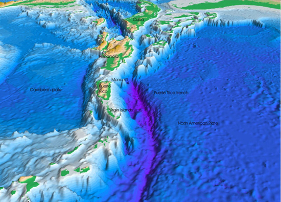
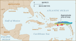
The Puerto Rico Trench is an oceanic trench located on the boundary between the Caribbean Sea and the Atlantic Ocean. The trench is associated with a complex transition between the subduction zone to the south along the Lesser Antilles island arc and the major transform fault zone or plate boundary that extends west between Cuba and Hispaniola through the Cayman Trench to the coast of Central America. Scientific studies have concluded that an earthquake occurring along this fault zone could generate a significant tsunami.
The island of Puerto Rico lies immediately to the south of the fault zone and the trench. The trench is 800 kilometres (500 mi) long and has a maximum depth of 8,605 metres (28,232 ft) at Milwaukee Deep, which is the deepest point in the Atlantic Ocean.
 The Puerto Rico Trench is located at a boundary between two plates that pass each other along a transform boundary with only a small component of subduction. The Caribbean Plate is moving to the east while the North American Plate is moving to the west. The North American Plate is being subducted by the Caribbean Plate to the southeast of the trench. This subduction zone explains the presence of active volcanoes over the southeastern part of the Caribbean Sea. Volcanic activity is frequent along the island arc southeast from Puerto Rico to the coast of South America.
Puerto Rico, the United States Virgin Islands, British Virgin Islands and the Dominican Republic do not have active volcanoes; however they are at risk from earthquakes and tsunamis. The Puerto Rico Trench is capable of producing earthquakes higher than Magnitude 8.0.

